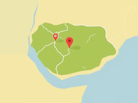
Imo State is one of the 36 states in Nigeria, located in the southeastern region of the country. The map of Imo State provides valuable insight into its geographical layout, political boundaries, transportation networks, and cultural landmarks. Understanding this map is crucial for anyone interested in the state’s development, tourism potential, administrative structure, or economic activities. The state is densely populated, with many urban and rural communities spread across its territory, making the map an essential tool for navigation, planning, and education.
Geographical Location of Imo State
Imo State is bordered by several other Nigerian states. To the north, it shares boundaries with Anambra State, while to the south, it is bordered by Rivers State. Abia State lies to the east, and Delta State is to the west. These surrounding states help define Imo’s strategic position within Nigeria’s southeastern zone.
On the map, Imo State appears as a compact landmass with a total area of approximately 5,530 square kilometers. The terrain is predominantly lowland, with occasional hills and ridges, and the state is crossed by several rivers, including the Imo River, from which it takes its name. The state’s vegetation is part of Nigeria’s tropical rainforest belt, which contributes to its lush greenery and fertile soil.
Administrative Divisions
The political map of Imo State is divided into 27 Local Government Areas (LGAs). Each LGA serves as an administrative unit, with its own headquarters, traditional leadership, and local governance structures. Some of the most prominent LGAs include
- Owerri Municipal
- Owerri North
- Owerri West
- Orlu
- Okigwe
- Mbaitoli
- Isiala Mbano
- Ideato North
- Ideato South
- Ohaji/Egbema
The capital city of Imo State is Owerri, which is centrally located and marked clearly on any standard map. Owerri serves as the economic, cultural, and administrative hub of the state.
Major Cities and Towns
Besides Owerri, the map of Imo State features a number of other major towns and urban centers. Each of these towns contributes to the state’s social and economic development. Key cities and towns include
- Orlu – A major commercial center in the western part of the state
- Okigwe – Known for its educational institutions and historical significance
- Mbaise – A large cultural region composed of several communities
- Nkwerre – Famous for blacksmithing and traditional craftsmanship
- Ngor Okpala – Strategically located close to the Imo International Cargo Airport
These towns are connected by a network of roads and highways, which are shown in detail on transportation maps of the state. This makes movement between different areas relatively accessible despite the state’s dense population.
Topographical Features
The topographic map of Imo State reveals a mostly flat landscape with occasional elevations. The land is largely arable, which has made agriculture a dominant activity in rural communities. Key rivers and streams can be found flowing throughout the state, such as the Njaba River and Otamiri River, both of which play an important role in local water supply and irrigation.
In certain parts of the state, particularly near the boundaries with Rivers and Delta states, the terrain becomes slightly more rugged, with swampy areas and flood plains. These features are vital for environmental studies and development planning.
Infrastructure and Transportation
Infrastructure maps of Imo State highlight its major highways, airports, and communication networks. The Owerri-Onitsha Road, Owerri-Aba Road, and Owerri-Port Harcourt Road are some of the most traveled routes, linking Imo with neighboring states and commercial centers.
Imo State is served by the Sam Mbakwe International Cargo Airport, located near Ngor Okpala. This airport is an important feature on any detailed map of the state. It supports domestic flights and facilitates economic activities such as trade and tourism.
Road Network
The internal road network connects all LGAs and towns within the state. Some roads are in better condition than others, and efforts are ongoing to improve rural access roads to support agricultural trade. Key junctions and roundabouts are often used as landmarks on city maps of Owerri and Orlu.
Economic Zones and Resources
On the economic map of Imo State, several zones stand out due to their production and industrial significance. The state is rich in natural resources such as crude oil, natural gas, clay, and limestone. Oil-producing areas, particularly in the Ohaji/Egbema and Oguta LGAs, are clearly marked for industrial and environmental monitoring purposes.
Agricultural areas are also significant. The fertile land supports the cultivation of crops like yam, cassava, maize, and oil palm. These agricultural zones are typically found in the central and northern parts of the state and are mapped for development projects and investment purposes.
Educational and Cultural Landmarks
The educational map of Imo State features prominent institutions such as
- Imo State University (IMSU) in Owerri
- Federal University of Technology, Owerri (FUTO)
- Alvan Ikoku Federal College of Education
These institutions are key landmarks that attract students from all over Nigeria. Cultural sites, such as traditional palaces and historical shrines, are also marked on tourism maps. They represent the rich heritage of the Igbo people, the dominant ethnic group in the state.
Tourism and Attractions
Tourist maps of Imo State highlight locations such as Oguta Lake, a natural freshwater lake in the western part of the state. The lake is a popular destination for recreation and cultural festivals. Other attractions include the Mbari Cultural Center in Owerri and traditional markets like Eke Ukwu Owerri.
These sites contribute to local tourism and are often promoted in state-sponsored travel brochures. Roads and access points to these areas are detailed in tourism-specific maps.
Security and Administrative Mapping
Security maps show the distribution of police stations, military posts, and other safety agencies across the state. These are particularly important for logistics planning and emergency response. Electoral maps are used during elections to show polling units, wards, and voting districts within each LGA.
The map of Imo State is more than a visual representation it is a vital tool that supports administration, development, transportation, tourism, and education. Whether viewed from a political, economic, or environmental perspective, understanding the layout and features of Imo State helps residents, visitors, researchers, and planners make informed decisions. With ongoing efforts to improve infrastructure and update geographic data, the map of Imo State continues to evolve as a reflection of its growing importance in Nigeria’s southeast region.