The current map of Ukraine reflects a complex and evolving geopolitical landscape, shaped by historical events, territorial disputes, and ongoing conflicts. Ukraine, located in Eastern Europe, shares borders with several countries including Russia, Belarus, Poland, Slovakia, Hungary, Romania, and Moldova. Its strategic position, vast natural resources, and cultural significance have made its territorial boundaries a focal point of regional and international attention. Understanding the current map of Ukraine involves looking into its administrative divisions, areas affected by conflict, and recent territorial changes that have influenced the country’s political and social dynamics.
Overview of Ukraine’s Geography and Borders
Location and Size
Ukraine is the largest country entirely within Europe, covering an area of approximately 603,000 square kilometers. It stretches from the Carpathian Mountains in the west to the expansive plains and steppes in the east, and from the Black Sea and Sea of Azov in the south up to the northern border with Belarus and Russia.
Neighboring Countries
- RussiaUkraine shares the longest border with Russia, approximately 1,944 kilometers. This border is central to ongoing territorial disputes and military tensions.
- BelarusTo the north, Ukraine shares a border with Belarus, spanning about 1,084 kilometers.
- Poland, Slovakia, HungaryThese Western neighbors form part of Ukraine’s European border.
- Romania and MoldovaLocated to the southwest and south, these borders connect Ukraine to the Balkans and the Black Sea.
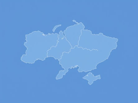
Administrative Divisions in the Current Map
Oblasts of Ukraine
Ukraine is divided into 24 oblasts (regions), each with its own administrative center. These oblasts form the primary political and administrative units of the country. Kyiv, the capital, is an independent municipality but also serves as the administrative center of Kyiv Oblast.
Special Status Regions
Besides oblasts, Ukraine includes two autonomous regions that have distinct administrative status
- CrimeaRecognized by Ukraine as an autonomous republic, Crimea was annexed by Russia in 2014, though this annexation is not internationally recognized.
- SevastopolA separate city with special status located on the Crimean Peninsula, also under Russian control since 2014.
Territorial Changes and Disputed Areas
Annexation of Crimea
In 2014, Russia annexed the Crimean Peninsula, a move widely condemned by the international community and considered illegal under international law. The annexation significantly altered the current map of Ukraine, as Crimea remains under Russian control despite Ukraine’s claims and international sanctions on Russia.
Conflict in Eastern Ukraine
The eastern regions of Donetsk and Luhansk, collectively known as the Donbas, have been embroiled in conflict since 2014. Pro-Russian separatists declared independence from Ukraine in these areas, resulting in ongoing clashes and a complex situation on the ground. Large parts of these oblasts are controlled by separatist groups, which has led to a de facto division in governance and contested borders within Ukraine’s internationally recognized territory.
Current Military Developments
Since 2022, the conflict escalated dramatically with Russia’s full-scale invasion of Ukraine. This has caused shifts in control over various territories, with frontlines fluctuating and new areas coming under Ukrainian or Russian control. The current map of Ukraine is therefore dynamic, with active military zones and changing territorial administration in affected regions.
Key Cities on the Current Map
Kyiv
The capital city of Kyiv remains under Ukrainian government control and serves as the political, economic, and cultural heart of the country. Its position is central both geographically and symbolically.
Kharkiv
Located in northeastern Ukraine, near the Russian border, Kharkiv is a major industrial and educational center. It has experienced significant military activity due to its proximity to conflict zones but remains a key city for Ukraine.
Odessa
On the Black Sea coast, Odessa is an important port city for Ukraine’s economy and trade. It has remained under Ukrainian control throughout recent conflicts and is vital for maritime access.
Donetsk and Luhansk
These cities are located within the conflict-affected Donbas region. Their control remains contested, with separatist authorities operating independently of the Ukrainian government in many parts.
Impact of Territorial Changes on Population and Governance
Displacement and Humanitarian Issues
The annexation of Crimea and conflict in eastern Ukraine have led to significant population displacement. Millions of Ukrainians have been forced to flee their homes, either internally or abroad, affecting demographics and social cohesion in various oblasts.
Administrative Challenges
Ukraine faces governance challenges in regions with limited control, complicating efforts for nationwide administration, infrastructure development, and service delivery. International organizations often step in to provide humanitarian aid and support to affected populations.
International Recognition and Map Representation
United Nations and Global Perspective
The United Nations and most countries recognize Ukraine’s sovereignty over Crimea and the eastern oblasts as defined before 2014, maintaining these territories on official maps as part of Ukraine. Maps may include dashed or dotted lines to indicate disputed areas or regions under foreign occupation.
Geopolitical Importance of Accurate Mapping
The current map of Ukraine plays a crucial role in diplomatic negotiations, military planning, and international aid distribution. Accurate representation of controlled and contested territories informs decision-making at multiple levels, from global powers to local authorities.
Future of Ukraine’s Territorial Integrity
Peace Efforts and Negotiations
Efforts to resolve territorial disputes continue through diplomatic channels such as the Minsk agreements and talks involving international mediators. The future map of Ukraine will largely depend on the outcomes of these processes and the resolution of ongoing conflicts.
Reconstruction and Development
Post-conflict reconstruction will be essential for reintegrating affected areas, rebuilding infrastructure, and restoring governance. A stable and unified Ukraine will influence the region’s stability and economic growth.
The current map of Ukraine reflects a nation facing significant challenges due to territorial disputes, conflict, and geopolitical pressures. Its administrative divisions, ongoing disputes in Crimea and the Donbas region, and shifting control areas are central to understanding the country’s situation. Despite these complexities, Ukraine maintains a resilient government and population committed to its sovereignty and future development. Accurate and up-to-date maps of Ukraine are vital for international diplomacy, humanitarian aid, and supporting peace initiatives that aim to restore stability and unity to the region.