Mount Mazama, located in the Cascade Range of southern Oregon, was once a towering stratovolcano that dominated the landscape before its dramatic eruption thousands of years ago. Today, it is best known for the beautiful Crater Lake that now fills its collapsed caldera. To understand when Mount Mazama erupted and how that eruption shaped the surrounding region, it’s essential to explore its geological history, eruption timeline, and the evidence left behind. The eruption of Mount Mazama was not only one of the most significant volcanic events in North America but also an important subject in the field of volcanology and geochronology.
The Formation of Mount Mazama
Geological Setting
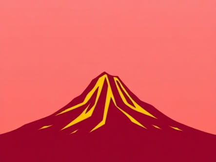
Mount Mazama was part of the Cascade Volcanic Arc, a region of volcanic activity stretching from British Columbia to Northern California. This arc is associated with the subduction of the Juan de Fuca Plate beneath the North American Plate, creating ideal conditions for the formation of volcanoes. Before its eruption, Mount Mazama stood approximately 12,000 feet (3,700 meters) tall and consisted of overlapping volcanic cones formed over hundreds of thousands of years.
Volcanic Growth
The growth of Mount Mazama occurred through multiple eruptions of andesite, dacite, and rhyodacite lavas. These eruptions contributed to the construction of a massive stratovolcano. Prior to its final eruption, the mountain had been volcanically active for more than 400,000 years. Its structure was complex, with numerous vents and lava domes scattered across the summit and flanks.
The Cataclysmic Eruption
Timing of the Eruption
The most significant eruption of Mount Mazama occurred approximately 7,700 years ago, during the Holocene epoch. Radiocarbon dating of organic material buried beneath volcanic deposits and the analysis of tephra layers in regional sediment cores helped scientists determine this time frame. The eruption date is generally cited as around 5,677 BCE.
Magnitude and Impact
This eruption was a Plinian event, meaning it was highly explosive and produced massive ash columns and pyroclastic flows. The eruption is estimated to have ejected about 50 cubic kilometers of magma, which is comparable in scale to the eruption of Mount Tambora in 1815. This volume of magma resulted in the collapse of the volcano’s summit, forming a large caldera that eventually became Crater Lake.
- Tephra from the eruption was dispersed over much of the Pacific Northwest and has been found in states as far as Alberta, Canada.
- Pyroclastic flows covered hundreds of square kilometers around the volcano.
- The eruption drastically altered the landscape and climate in the immediate region.
Formation of Crater Lake
Collapse of the Caldera
After the explosive eruption emptied the magma chamber beneath Mount Mazama, the structural support for the mountain’s summit was lost. This caused the summit to collapse inward, creating a massive caldera approximately 6 miles (10 kilometers) in diameter. The formation of the caldera was not an explosive event itself but a result of the withdrawal of magma.
Water Accumulation
Over time, the caldera filled with rainwater and snowmelt, eventually forming Crater Lake. With no rivers flowing into or out of the lake, its water levels are maintained by a delicate balance of precipitation and evaporation. Crater Lake is now the deepest lake in the United States, reaching depths of nearly 1,949 feet (594 meters).
Evidence of the Eruption
Volcanic Deposits
The region surrounding Mount Mazama is filled with evidence of its massive eruption. Layers of pumice and ash, known as the Mazama Ash, are found in various locations across western North America. These deposits help geologists identify the reach and intensity of the eruption.
Climatic Effects
The large volume of volcanic ash and sulfur gases released into the atmosphere likely contributed to short-term climate cooling. Some researchers believe the eruption may have caused regional temperature drops and affected vegetation patterns, although global effects were probably limited compared to more recent eruptions such as Krakatoa or Pinatubo.
Archaeological Evidence
In some archaeological sites in the Pacific Northwest, tools and artifacts have been found buried beneath layers of Mazama Ash, indicating human presence in the region at the time of the eruption. These findings suggest that indigenous populations witnessed or were affected by the eruption, making it a significant cultural as well as geological event.
Ongoing Volcanic Activity and Monitoring
Post-Eruption Activity
Although the major eruption occurred around 7,700 years ago, Mount Mazama has not been entirely dormant. Post-caldera volcanic activity produced features such as Wizard Island, a cinder cone that rises above Crater Lake’s surface. Several other volcanic features remain submerged beneath the lake.
Modern Monitoring Efforts
Today, the region is monitored by the United States Geological Survey (USGS) for signs of renewed volcanic activity. While the likelihood of another massive eruption is low in the near future, Mount Mazama is still considered a potentially active volcano. Seismic monitoring, gas emissions studies, and satellite imagery help scientists keep an eye on the volcano’s status.
Scientific Significance
Use in Tephrochronology
The widespread distribution of Mazama Ash makes it a valuable marker bed in the field of tephrochronology the study of volcanic ash layers for dating and correlating geological events. Because this ash layer is well-dated and easily recognizable, it serves as an important chronological tool in both geological and archaeological studies.
Insights into Caldera Formation
The Mount Mazama eruption is one of the best-studied examples of caldera collapse and has helped volcanologists understand similar structures around the world. Its preservation as Crater Lake offers a rare opportunity to study the aftermath of a large-scale explosive eruption and the processes involved in lake formation inside a caldera.
Mount Mazama’s eruption, which occurred around 7,700 years ago, was one of the most powerful volcanic events in the history of North America. Its violent explosion reshaped the landscape, gave rise to Crater Lake, and left behind a legacy of geological evidence that continues to inform scientific research today. The eruption not only transformed the physical environment but also left a lasting imprint on the region’s ecosystems and human populations. Understanding when Mount Mazama erupted and how it erupted offers critical insight into volcanic hazards, climate change, and Earth’s dynamic geological processes.