Slovakia, a landlocked country in Central Europe, offers a unique geographic and cultural position that makes its map especially interesting for travelers, historians, and geopolitics enthusiasts. Surrounded by five countries and nestled in the heart of Europe, Slovakia serves as a vital corridor between Eastern and Western Europe. The map of Slovakia and surrounding countries reveals much more than borders; it shows natural connections, historic influences, and regional dynamics that shape the country’s identity and strategic role on the continent.
Geographical Overview of Slovakia
Location and Topography
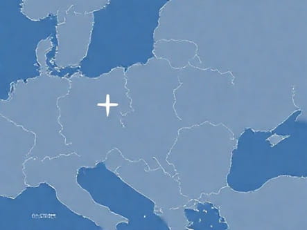
On the map, Slovakia is located at the crossroads of Central Europe, bordered by Poland to the north, Ukraine to the east, Hungary to the south, Austria to the southwest, and the Czech Republic to the northwest. The country spans about 49,000 square kilometers and is mostly mountainous, with the Carpathian Mountains dominating the northern and central regions. The map clearly shows the Tatra Mountains, which form a natural border with Poland and include the country’s highest peak, Gerlachovský štít.
Slovakia’s central and southern regions transition into lowlands, particularly the Danubian Lowland, which is rich in agriculture and population centers. The map also includes major rivers such as the Danube, Váh, and Hron, which flow across or along the country and serve both historical and modern purposes for trade, settlement, and tourism.
Major Cities and Regions
Maps of Slovakia highlight key cities that act as administrative, cultural, and economic hubs
- Bratislava– The capital city, located in the southwest along the Danube River, near the borders with Austria and Hungary.
- Košice– The largest city in eastern Slovakia, near the Ukrainian border.
- Nitra, Žilina, Banská Bystrica, and Prešov– These are important regional centers that also appear prominently on any national map.
The map is typically divided into eight administrative regions, each of which is named after its principal city. These regions play an important role in governance and development planning.
Slovakia’s Borders and Neighboring Countries
Map Features of Surrounding Nations
The map of Slovakia and surrounding countries provides essential context for understanding the nation’s relationships and shared history. Each bordering country has distinct geographical and political characteristics that influence their ties with Slovakia.
Czech Republic
To the northwest lies the Czech Republic, with which Slovakia shares deep historical roots, most notably as part of former Czechoslovakia until the peaceful dissolution in 1993. Maps of this region often show shared infrastructure and cultural routes. The Moravian-Silesian region of the Czech Republic connects easily with Slovakia’s Trenčín and Žilina regions.
Austria
Austria lies to the southwest, with a relatively short but significant border near Bratislava. A close look at the map shows how uniquely positioned Bratislava is it’s one of the few capitals in the world situated near two international borders. The Austrian region of Lower Austria borders Slovakia, with Vienna located just 60 kilometers west of Bratislava. Transport corridors between the two capitals are easily visible on detailed regional maps.
Hungary
Hungary shares Slovakia’s southern border, a region marked by the Danube River. This long border stretches from west to east, and cities like Komárno and Štúrovo lie directly across from their Hungarian counterparts. The map of this region is rich with historical sites and cross-border ethnic communities, especially ethnic Hungarians residing in southern Slovakia.
Ukraine
To the east, Slovakia borders Ukraine for about 97 kilometers. This is the country’s only border with a non-Schengen, non-EU nation. The map highlights the Uzhhorod border crossing, which is a key transit point. Eastern Slovakia and western Ukraine share mountainous terrain, including parts of the Carpathians, and are linked by history and minority populations.
Poland
Slovakia’s northern neighbor is Poland, with which it shares the High Tatras and Low Tatras mountain ranges. The border is marked by high elevations and numerous national parks, making it a popular area for tourism. The Orava and Spiš regions of Slovakia border southern Poland, and this zone is culturally rich and historically interconnected. Key crossings such as the one near the town of Tatranská Javorina are labeled on most detailed maps.
Transportation and Infrastructure Network
Major Roads and Railways on the Map
The map of Slovakia and surrounding countries includes a well-developed road and rail network that reflects the country’s role as a transit hub in Europe. Key highways and railway lines connect Bratislava with cities like Vienna, Budapest, and Prague. The D1 motorway is a major east-west route, while the R1 and R7 routes serve central and southern regions.
Rail lines also cross the borders at multiple points, notably
- Bratislava to Vienna (Austria)
- Košice to Miskolc (Hungary)
- Čadca to Ostrava (Czech Republic)
- Prešov to Lviv via Uzhhorod (Ukraine)
International Airports
The map marks Slovakia’s key airports, with the most prominent being M. R. Štefánik Airport in Bratislava. Other important airports include those in Košice and Poprad-Tatry. Bratislava’s airport serves as an alternative to Vienna International Airport due to its close proximity.
Cultural and Natural Landmarks
UNESCO Sites and Protected Areas
Several UNESCO World Heritage Sites in Slovakia are marked on thematic maps, including
- Vlkolínec – a traditional village in the mountains
- Levoča and Spiš Castle – historical sites in eastern Slovakia
- Caves of Aggtelek and Slovak Karst – transboundary with Hungary
Natural parks such as Slovenský raj (Slovak Paradise) and the High Tatras are also clearly identified on topographical and tourist maps.
Historical Crossroads
The map reveals Slovakia’s position at the historical crossroads of the Roman Empire, Ottoman expansion, and Austro-Hungarian influence. Border zones reflect this heritage through place names, architecture, and linguistic diversity.
Strategic and Political Importance
EU and Schengen Membership
Slovakia’s position on the map within the Schengen Area plays a critical role in its political geography. The country serves as an eastern edge of the EU, sharing a border with non-EU Ukraine. Maps of border control zones often show the differences between internal and external EU boundaries.
Defense and Trade Routes
Slovakia’s map is also relevant for understanding NATO logistics, energy routes, and international pipelines that pass through the region. It’s a corridor for gas supplies from east to west and has rail links that form part of broader Trans-European Networks (TEN-T).
The map of Slovakia and surrounding countries offers a deep view into the heart of Central Europe. It’s not merely a geographic tool but a reflection of cultural links, historical shifts, and modern infrastructure. From its mountainous north to its lowland south, and from historic ties to Austria and Hungary to its border with Ukraine, Slovakia stands as a nation shaped by its geography. For anyone seeking to understand the dynamics of this region, studying the map in detail reveals the many layers of connectivity and identity that define Slovakia and its neighbors.