Mount Mazama was once a towering stratovolcano located in what is now southern Oregon, in the United States. Today, it is better known for the massive caldera that remains Crater Lake, one of the most pristine and visually striking bodies of water in North America. But behind its beauty lies a dramatic geological past. To understand the origins of Crater Lake, we must look back in time and examine the major eruption that destroyed Mount Mazama. This event was one of the most powerful volcanic eruptions in the history of the Cascade Range, and its timing and consequences remain important to geologists, historians, and nature lovers alike.
The Eruption of Mount Mazama
When Did Mt Mazama Erupt?
The cataclysmic eruption of Mount Mazama occurred approximately7,700 years ago, around 5,677 BCE. This date is not based on historical records, since it predates written history in North America, but rather on radiocarbon dating of organic material buried by volcanic ash and other scientific methods. The eruption was so powerful that it emptied the magma chamber beneath the mountain, causing the summit to collapse and form a large caldera. That caldera eventually filled with water, becoming the famous Crater Lake we see today.
The dating of the eruption has been confirmed through various geological techniques, including the analysis of tree rings, volcanic ash layers in ice cores, and radiocarbon dating of wood buried in ash. These findings consistently place the eruption at around 7,700 years ago, give or take a few decades. This timing makes the Mount Mazama eruption one of the most significant geological events of the Holocene epoch in North America.
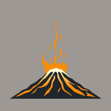
Magnitude and Impact of the Eruption
How Powerful Was the Eruption?
Mount Mazama’s eruption was classified as a VEI-7 (Volcanic Explosivity Index) event, which means it was exceptionally powerful comparable in magnitude to the 1815 eruption of Mount Tambora in Indonesia. VEI-7 eruptions are extremely rare and represent some of the most massive volcanic events on Earth. The eruption released approximately 50 cubic kilometers of magma into the atmosphere in the form of pumice, ash, and pyroclastic flows.
- Estimated VEI 7
- Magma volume About 50 cubic kilometers
- Crater formation depth Approximately 1,200 meters
- Ash dispersal Spanned much of the Pacific Northwest and beyond
The ash cloud from the eruption traveled vast distances, with tephra (volcanic ash) deposits discovered as far away as Canada, the Great Plains, and even Greenland in ice core samples. The environmental effects were dramatic, including temporary cooling due to volcanic aerosols in the atmosphere and devastation of local ecosystems.
Collapse of the Mountain
The eruption was so intense that the mountain could no longer support itself. After the initial explosive phase, the emptying of the magma chamber beneath Mount Mazama caused the summit and upper slopes to collapse inward, forming a caldera roughly 8 kilometers (5 miles) in diameter. This collapse was not instantaneous but occurred as the eruption progressed and the internal pressure decreased.
Formation of Crater Lake
How Crater Lake Came to Be
Following the collapse of Mount Mazama, the newly formed caldera began to fill with water, primarily from rainfall and snowmelt. There are no rivers that flow into or out of the lake, so its water balance is maintained entirely by precipitation and evaporation. Over several centuries, the caldera became what is now known as Crater Lake, which is famous for its deep blue color and exceptional clarity.
- Lake depth 594 meters (1,949 feet), making it the deepest lake in the United States
- Water source Precipitation (rain and snow)
- No inlets or outlets Water leaves only through evaporation and seepage
Geologically, Crater Lake is still an active volcanic area, although there have been no major eruptions since the one that formed the caldera. Some smaller volcanic activity has occurred since then, most notably the formation of Wizard Island, a cinder cone that rises above the lake’s surface and was created by subsequent eruptions inside the caldera.
Cultural and Archaeological Significance
Native American Accounts
Native American oral traditions provide compelling narratives that are thought to describe the eruption of Mount Mazama. Tribes such as the Klamath people have passed down stories for generations that speak of a massive battle between gods or spirits, fire raining from the sky, and a mountain collapsing into the earth. These stories are believed to be cultural memories of the eruption, preserved across thousands of years.
Some archaeological evidence suggests that humans were living in the area at the time of the eruption. Tools, charred wood, and other signs of habitation have been discovered beneath Mazama ash layers, indicating that early human communities witnessed the event firsthand and were directly affected by its aftermath.
Geological Evidence and Modern Studies
Tephra Layers and Dating Methods
The key to accurately dating the eruption of Mount Mazama lies in tephrochronology the study of volcanic ash layers. These layers, often called Mazama Ash,” can be identified across the western United States and are used as markers in archaeological and paleoclimatic studies. Because Mazama Ash has a unique chemical composition, it is easy to distinguish from ash produced by other eruptions.
Radiocarbon dating of wood found beneath the ash has helped pinpoint the timing of the eruption. In addition, ice core samples from Greenland and lake sediments across North America contain evidence of the atmospheric changes caused by the eruption, further confirming the date.
Ongoing Research and Volcanic Monitoring
Today, scientists continue to study Crater Lake and the remains of Mount Mazama to understand more about volcanic processes and hazards. Although the area is not currently considered at high risk for a new eruption, the U.S. Geological Survey (USGS) monitors the site for any signs of volcanic activity. This includes seismic studies, gas emissions, and ground deformation measurements.
Environmental and Climatic Effects
The eruption had significant short-term environmental impacts. The massive volume of ash and gas released into the atmosphere likely caused temporary climate cooling, known as volcanic winter. Plant and animal life in the immediate vicinity were devastated, and it took years or even centuries for the ecosystem to recover fully.
In the long term, the eruption left behind a unique and ecologically rich environment. Crater Lake supports a variety of plant and animal life today, both native and introduced, and the caldera’s steep walls and surrounding forests are home to many species found in the Pacific Northwest.
Mount Mazama erupted approximately 7,700 years ago in one of the most powerful volcanic events of the Holocene epoch. The eruption reshaped the landscape of southern Oregon, destroyed the original peak of the mountain, and left behind a vast caldera that eventually became Crater Lake. The event was recorded not only in geological data but also in the oral traditions of local Native American tribes. Today, the remnants of Mount Mazama continue to captivate scientists, historians, and visitors alike. Through ongoing research and careful preservation, we continue to learn more about this extraordinary eruption and its lasting impact on the region and the world.