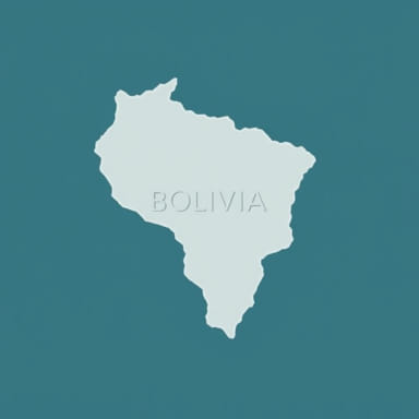
Bolivia is a landlocked country located in the heart of South America. It occupies a central position on the continent, bordered by several countries that shape its geography and geopolitical relationships. To understand where Bolivia is on the map, it is essential to look at its neighboring countries, natural regions, and latitude and longitude coordinates. Bolivia’s position gives it access to a wide range of landscapes, from the towering Andes Mountains to the vast Amazon Basin. Its location is both strategic and unique, placing it at the crossroads of several important ecological and cultural zones in South America.
Geographical Coordinates and Regional Placement
Latitude and Longitude of Bolivia
Bolivia is situated approximately between latitudes 10° and 23° South, and longitudes 57° and 69° West. This places the country entirely in the Southern Hemisphere and to the west of the Prime Meridian. Because of its geographic span, Bolivia crosses both tropical and subtropical zones, which gives it a varied climate and landscape.
Central Location in South America
When looking at a map of South America, Bolivia appears almost at the center. This central location has significant implications for trade, travel, and cultural exchange. Although it does not have a coastline, Bolivia’s centrality provides access to neighboring countries with ports and facilitates overland connections across the continent.
Bordering Countries
Neighbors to the West and Southwest
- PeruLocated to the northwest, Peru shares a border with Bolivia that includes parts of Lake Titicaca, the world’s highest navigable lake.
- ChileTo the southwest, Chile shares a border with Bolivia across the Atacama Desert. This area has historically been significant in disputes over sea access.
Neighbors to the East and South
- BrazilTo the north and east, Bolivia borders Brazil. This long boundary stretches across tropical forests and is important for economic and environmental cooperation.
- ParaguayLocated to the southeast, Paraguay shares a relatively short but important border with Bolivia, mainly in the Gran Chaco region.
- ArgentinaTo the south, Bolivia meets Argentina, a country with which it shares strong cultural and economic ties.
Topographical Features of Bolivia
The Andean Highlands
The western portion of Bolivia is dominated by the Andes Mountains, which split into two main ranges the Cordillera Occidental and Cordillera Oriental. Between these ranges lies the Altiplano, a high plateau that includes major cities like La Paz, El Alto, and Oruro. This region is where Bolivia reaches its highest altitudes, including Mount Sajama, the country’s tallest peak.
Amazon Basin and Lowlands
To the north and northeast, Bolivia transitions into the Amazon Basin. This area includes dense rainforest, rivers, and diverse wildlife. The Beni and Pando departments are part of this region and are less densely populated but ecologically important. These areas connect Bolivia to the vast Amazon ecosystem shared with Brazil, Peru, and other countries.
The Gran Chaco and Eastern Plains
In the southeast, Bolivia’s terrain changes into dry lowlands and scrub forests known as the Gran Chaco. This region, which extends into Argentina and Paraguay, is less mountainous and supports agriculture and cattle grazing. The eastern plains, particularly in the department of Santa Cruz, are among the most economically productive regions of Bolivia.
Major Cities and Their Locations
La Paz and El Alto
La Paz, one of Bolivia’s administrative capitals, is located in the western part of the country at high altitude in the Andes. It is the highest capital city in the world. Nearby, El Alto sits on the edge of the Altiplano and is one of Bolivia’s fastest-growing cities. Together, they form the largest metropolitan area in the country.
Sucre
Sucre, the constitutional capital of Bolivia, is located further to the southeast in the department of Chuquisaca. It sits at a lower elevation than La Paz and is known for its colonial architecture and historical significance.
Santa Cruz de la Sierra
Located in the eastern lowlands, Santa Cruz is Bolivia’s largest city by population and a major economic hub. It sits closer to the Brazilian border and has become a center of commerce, agriculture, and industry.
Cochabamba
In the central region of Bolivia lies Cochabamba, known as the City of Eternal Spring because of its pleasant climate. It occupies a valley surrounded by mountains and serves as a cultural and agricultural center.
Map Reading Tips to Locate Bolivia
Identifying Bolivia on a Political Map
On a political map of South America, Bolivia is easy to locate by finding the country near the center of the continent, bordered by six other nations. It stands out as one of two landlocked countries in South America, the other being Paraguay.
Finding Bolivia on a Physical Map
A physical map will highlight the Andes Mountains in the west and the lowlands in the east. Look for Lake Titicaca along the western border with Peru and trace the Amazon tributaries through the north and east. These features help define Bolivia’s physical identity on the map.
Using Digital Maps and Coordinates
Online maps and GPS tools often allow users to locate Bolivia using coordinates. Typing 16.2902° S, 63.5887° W” into a digital map application will center the display on Bolivia. Satellite view can show the variation in terrain, from snowcapped mountains to green rainforests.
Importance of Bolivia’s Location
Geopolitical Significance
Bolivia’s location gives it access to multiple neighboring countries and makes it a potential transit route for regional infrastructure, such as gas pipelines and railways. Although landlocked, Bolivia maintains special port access agreements with Peru and Chile, enabling it to engage in international trade.
Cultural and Ecological Diversity
Because of its placement between the Andes and the Amazon, Bolivia hosts an incredible range of ecosystems and cultures. Indigenous communities in the highlands differ significantly from those in the lowlands, and the country’s geography reflects that diversity.
Bolivia is located in central South America, landlocked but surrounded by a diverse group of neighboring countries. It occupies a key geographic position that connects the Andes Mountains with the Amazon Basin and the Gran Chaco. On the map, Bolivia is identifiable by its unique shape and central location, with important cities like La Paz, Santa Cruz, Sucre, and Cochabamba spread across various terrains. Understanding where Bolivia is on the map helps reveal the country’s historical, ecological, and geopolitical importance in South America. Whether viewed from a physical or political perspective, Bolivia’s position makes it an essential piece of the continental puzzle.