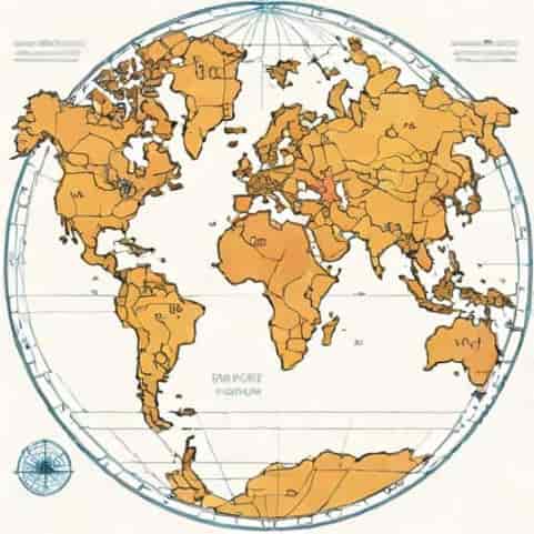
The Ulm Ptolemy world map is one of the most fascinating cartographic artifacts from the Renaissance period, reflecting both the revival of classical knowledge and the expanding European understanding of the world. Created in 1482 in Ulm, Germany, this map was based on the work of Claudius Ptolemy, the 2nd-century Greco-Roman mathematician, astronomer, and geographer whose text, Geographia, outlined the concepts of latitude and longitude and described the known world of his time. The Ulm Ptolemy world map represents a remarkable blend of classical knowledge and late medieval European cartographic skill. It not only provides a glimpse into how Europeans perceived the world in the late 15th century but also serves as a historical record of the transmission of geographic knowledge from antiquity to the Renaissance. By examining this map, historians and geographers gain insight into the evolution of world maps and the influence of Ptolemaic principles on early modern cartography.
Historical Background of the Ulm Ptolemy World Map
The Ulm Ptolemy world map was produced during a period when European explorers were beginning to expand their horizons through maritime exploration. Ulm, a prominent city in southern Germany, was a center of trade, learning, and printing, making it an ideal location for the creation of such a map. The map was based on the work of Claudius Ptolemy, whose Geographia was rediscovered and translated into Latin in the 15th century. Ptolemy’s work introduced the concept of using a coordinate system to represent locations on Earth, a revolutionary idea that influenced mapmaking for centuries. The Ulm edition adapted Ptolemy’s coordinates to the printing techniques of the time, creating a map that was both practical and symbolic, reflecting the European understanding of global geography before the discoveries of the Age of Exploration fully expanded that knowledge.
Ptolemy’s Influence on Cartography
Ptolemy’s Geographia was a foundational text in the history of cartography, providing detailed instructions for creating maps using latitude and longitude. The Ulm Ptolemy world map follows Ptolemy’s methods but also incorporates new information available to European scholars in the 15th century. Ptolemy’s influence is evident in the grid system of the map, the proportional relationships between regions, and the inclusion of classical place names. While the map does not accurately depict all parts of the world by modern standards, it demonstrates an effort to reconcile classical knowledge with contemporary observations. This fusion of old and new knowledge marks an important stage in the development of world maps.
Features of the Ulm Ptolemy World Map
The Ulm Ptolemy world map has several distinctive features that set it apart from other maps of the period. It includes a detailed representation of Europe, Asia, and Africa, following Ptolemy’s geographic descriptions. The map is centered on the Mediterranean region, reflecting the European focus on trade and classical knowledge. Major rivers, mountain ranges, and cities are depicted, often with artistic embellishments to enhance their visibility. The map also features a coordinate grid, allowing for approximate calculation of distances between locations. This combination of practical and decorative elements illustrates the Renaissance approach to cartography, which valued both utility and aesthetic appeal.
Artistic and Symbolic Elements
In addition to its geographic accuracy, the Ulm Ptolemy world map includes artistic and symbolic elements common in Renaissance maps. Decorative borders, illustrations of ships, and mythological figures convey both knowledge and cultural values. These embellishments serve to make the map visually engaging while also reinforcing the idea of European mastery over knowledge and geography. The inclusion of symbolic imagery reflects the Renaissance belief that maps could communicate more than spatial information-they could convey cultural and intellectual perspectives about the world and humanity’s place within it.
Significance in the History of Cartography
The Ulm Ptolemy world map holds a special place in the history of cartography because it represents a transitional moment between classical and modern mapping techniques. By combining Ptolemaic principles with contemporary European knowledge, the map exemplifies the Renaissance approach to science and scholarship. It also predates the major voyages of discovery by explorers such as Christopher Columbus and Vasco da Gama, providing a baseline for understanding how Europeans viewed the world before the New World and sea routes to Asia were fully charted. Historians consider the Ulm map an important artifact for studying the development of geographic knowledge, the influence of classical texts, and the role of printing technology in disseminating information.
Impact on Later Maps
The Ulm Ptolemy world map influenced many subsequent cartographers, particularly in Europe. By establishing a printed model for how Ptolemaic geography could be visualized, the map set standards for scale, proportion, and grid use in later maps. Cartographers in Italy, Germany, and the Low Countries drew inspiration from the Ulm edition when producing their own Ptolemaic maps, spreading the ideas of latitude and longitude more widely. The Ulm map also demonstrated the potential of printed maps as educational tools, making geographic knowledge more accessible to scholars, traders, and educated elites throughout Europe.
Comparison with Modern World Maps
While the Ulm Ptolemy world map was a remarkable achievement for its time, it differs significantly from modern maps in terms of accuracy and coverage. The map’s depiction of Asia and Africa is often distorted, reflecting limited knowledge of these regions. The Americas are absent, as they had not yet been discovered by Europeans. Despite these limitations, the Ulm map provides valuable insight into the state of geographic knowledge in the 15th century. Modern maps benefit from precise measurements, satellite imagery, and advanced projections, but the Ulm Ptolemy world map remains important for understanding the historical evolution of mapping and human attempts to represent the world accurately.
Lessons from Historical Maps
Studying the Ulm Ptolemy world map teaches us about the methods, assumptions, and priorities of early cartographers. It shows how maps are influenced by cultural, intellectual, and technological factors, and how they reflect the worldview of their creators. By analyzing these historical maps, researchers can trace the development of geographic knowledge, the spread of information, and the impact of printing technology on science and education. The Ulm map also highlights the importance of critical thinking in interpreting historical sources, as early maps often combine observation, estimation, and tradition in ways that differ from modern scientific standards.
The Ulm Ptolemy world map is a remarkable historical artifact that bridges classical knowledge and Renaissance innovation. Created in 1482, it reflects the influence of Claudius Ptolemy’s Geographia, incorporating coordinate systems, proportional relationships, and classical place names while also showcasing Renaissance artistic and decorative elements. The map provides insight into how Europeans understood the world before the major voyages of discovery, highlighting both the limitations and achievements of early cartography. Its impact on later mapmaking, educational practices, and the dissemination of geographic knowledge underscores its significance in the history of cartography. Studying the Ulm Ptolemy world map allows us to appreciate the evolution of geographic thought and the enduring legacy of Ptolemy’s work in shaping how humans visualize and interpret the world around them.