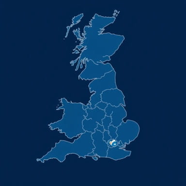
When exploring the geography of England, one of the most useful tools is a map showing the counties. Counties are the traditional and administrative divisions of the country, and each has its own unique history, culture, and geography. These boundaries are not only essential for governance but also help people understand regional identity across the country. England’s county map provides insight into the layout of both urban centers and rural landscapes, offering a clear picture of how the nation is organized territorially.
Understanding Counties in England
What Are Counties?
Counties in England refer to geographical and administrative areas that divide the country into manageable regions. They have been in existence for centuries, originally established for administrative, judicial, and military purposes. Over time, counties have become important in local identity and regional governance. There are different types of counties including ceremonial, administrative, and historic counties, each with its own boundaries and functions.
Types of Counties
- Historic CountiesThese date back to the Middle Ages and are still referenced in cultural and historical contexts.
- Administrative CountiesUsed by local governments for service delivery, these may vary slightly from historic boundaries.
- Ceremonial CountiesOften aligned with lieutenancy areas, they are associated with royal representation and public events.
Regional Divisions of England
England is typically divided into nine official regions, each containing a number of counties. These regions are not administrative in themselves but help group counties based on geographical and socio-economic factors. Understanding these regions helps place the counties into broader geographical context.
The Nine Regions
- North East
- North West
- Yorkshire and the Humber
- East Midlands
- West Midlands
- East of England
- London
- South East
- South West
Major Counties and Their Characteristics
North East England
This region includes counties such as Northumberland, Tyne and Wear, and County Durham. It is known for its industrial heritage, historic castles, and rugged coastline.
North West England
Comprising counties like Lancashire, Cheshire, and Cumbria, this region features both urban centers like Manchester and Liverpool as well as the scenic Lake District National Park.
Yorkshire and the Humber
Home to North Yorkshire, West Yorkshire, South Yorkshire, and the East Riding of Yorkshire, this area blends rural beauty with urban development. Cities like Leeds and Sheffield are major economic hubs.
East Midlands
Counties here include Derbyshire, Leicestershire, Lincolnshire, Northamptonshire, Nottinghamshire, and Rutland. This central region combines historical market towns with modern manufacturing cities.
West Midlands
This region contains Warwickshire, Worcestershire, Staffordshire, Shropshire, Herefordshire, and the metropolitan county of West Midlands, which includes Birmingham. It is known for its industrial legacy and cultural diversity.
East of England
This area includes Norfolk, Suffolk, Essex, Cambridgeshire, Bedfordshire, and Hertfordshire. With coastal towns, farmlands, and proximity to London, the region has both rural and commuter characteristics.
London
Greater London is a unique administrative county and region, composed of 32 boroughs and the City of London. It is England’s capital and its most populous area, central to governance, finance, and culture.
South East England
Encompassing Kent, Surrey, Sussex (East and West), Hampshire, Oxfordshire, Buckinghamshire, Berkshire, and the Isle of Wight, this region is one of the most economically developed and densely populated areas.
South West England
Counties in this region include Cornwall, Devon, Somerset, Dorset, Gloucestershire, and Wiltshire. It is known for its coastal scenery, agricultural land, and historical sites like Stonehenge.
Uses of a County Map
Travel and Tourism
A map of England showing counties is invaluable for tourists. It helps identify the location of cities, national parks, and coastal areas, making it easier to plan travel routes and experiences. Each county offers unique attractions, so having a county-based map ensures thorough exploration.
Educational and Historical Insight
Students and historians often rely on county maps to study the development of English governance, political boundaries, and cultural evolution. Understanding where each county lies and how it connects to others adds depth to studies of British history.
Government and Public Services
Local governance in England often operates at the county level. Services such as education, transportation, and policing are coordinated by county councils. Therefore, maps showing counties are essential for administrative purposes and public policy planning.
Regional Identity
Many people in England strongly identify with their counties. Whether it’s supporting a county cricket team or attending local festivals, the county remains a significant part of personal and regional identity. Maps help maintain this sense of place and belonging.
County Boundaries and Changes
Modern Adjustments
While historic counties have remained relatively stable, administrative boundaries have seen adjustments, especially in the 20th century. The Local Government Act of 1972 brought major reforms, altering some borders and creating new administrative units. For example, Avon was created and later dissolved, with its territory divided among surrounding counties.
Metropolitan and Non-Metropolitan Counties
- Metropolitan CountiesThese are large urban areas such as Greater Manchester, Merseyside, and West Midlands. They include major cities and are subdivided into boroughs.
- Non-Metropolitan CountiesAlso called shire counties, these cover more rural and semi-urban areas. They include well-known counties like Kent, Surrey, and Norfolk.
A map of England showing counties is more than a geographical tool; it is a window into the country’s structure, identity, and history. From the bustling heart of London to the serene countryside of Northumberland, each county tells its own story. Whether for education, travel, governance, or personal interest, understanding England’s counties enhances one’s appreciation of this historically rich and geographically diverse nation. By exploring the counties on a map, you gain a better sense of how England functions, where its cultures thrive, and how its past continues to shape its present.