The barometer is a fundamental instrument in geography, meteorology, and environmental sciences, providing crucial information about atmospheric pressure. By measuring changes in air pressure, barometers help geographers, meteorologists, and researchers understand weather patterns, predict climatic events, and study the interaction between the atmosphere and the Earth’s surface. Its applications in geography extend from practical weather forecasting to academic research, enabling a deeper understanding of the physical environment. The versatility and accuracy of barometers make them indispensable tools for both fieldwork and laboratory studies in geographical sciences.
Understanding the Barometer
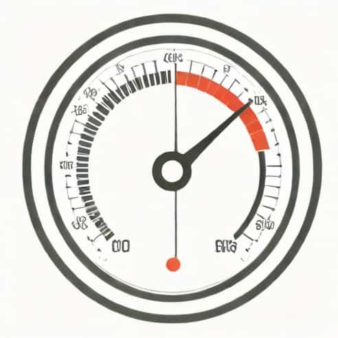
A barometer is an instrument that measures atmospheric pressure, which is the weight of the air column above a given point on Earth. There are different types of barometers, including mercury barometers, aneroid barometers, and digital barometers. Mercury barometers use a column of mercury to gauge air pressure, while aneroid barometers use a sealed, flexible metal chamber that expands or contracts with pressure changes. Digital barometers provide electronic readings and can be integrated into modern weather monitoring systems. Regardless of the type, the barometer provides a reliable measure of air pressure, which is essential in geography for understanding weather, climate, and environmental conditions.
Principle of Operation
The operation of a barometer is based on the principle that changes in atmospheric pressure affect a physical medium. In mercury barometers, for example, air pressure pushes on a reservoir of mercury, causing the mercury level in a tube to rise or fall. In aneroid barometers, a flexible chamber responds to pressure changes, moving a needle on a dial. These readings can then be interpreted to assess weather changes, altitude, and air mass movements. Understanding this principle allows geographers to accurately interpret barometric data for research and practical applications.
Uses of Barometer in Geography
Barometers are versatile tools in geography, with applications spanning weather prediction, climate studies, and environmental monitoring. Their ability to measure atmospheric pressure provides insights into both local and large-scale geographical phenomena.
Weather Forecasting
One of the primary uses of a barometer in geography is weather forecasting. Atmospheric pressure is directly related to weather conditions
- High PressureTypically associated with clear skies and stable weather, high-pressure readings help predict calm and sunny conditions.
- Low PressureOften indicates stormy or rainy weather, as low-pressure areas are associated with rising air and cloud formation.
- Pressure TrendsSudden drops in pressure can signal approaching storms or cyclones, allowing geographers and meteorologists to issue timely warnings.
By monitoring pressure trends over time, geographers can analyze local weather patterns and provide valuable data for agriculture, disaster management, and urban planning.
Studying Altitude and Topography
Barometers are also used to measure altitude in geographic fieldwork. Since atmospheric pressure decreases with elevation, barometers can determine the height of mountains, hills, and plateaus. This is particularly useful in remote or inaccessible regions where GPS technology may be limited. Geographers use these readings to map terrain, study topographic variations, and understand the relationship between altitude and climate, vegetation, or human settlement patterns.
Climate Research
Long-term barometric data contribute to climate research and the study of atmospheric conditions. By analyzing pressure changes over time, geographers can identify seasonal patterns, monsoon behaviors, and climatic shifts. Barometers help in understanding phenomena such as El Niño and La Niña, which are influenced by atmospheric pressure variations across different regions. This data is crucial for creating climate models, predicting future climate trends, and assessing environmental impacts on human and ecological systems.
Monitoring Storms and Natural Disasters
Barometers play a critical role in monitoring extreme weather events and natural disasters. Low-pressure readings can indicate the formation of hurricanes, typhoons, or cyclones. By tracking these pressure changes, geographers and meteorologists can provide early warnings, helping communities prepare and reduce potential damage. In addition, barometric data can assist in flood prediction, drought assessment, and studying the impact of storms on geographic features such as coastlines and river systems.
Navigation and Oceanography
Barometers are essential tools for navigation, particularly in maritime geography. Sailors and oceanographers use barometric pressure readings to anticipate weather changes at sea, ensuring safer voyages. Low-pressure areas may indicate rough seas or storms, while high-pressure zones suggest calmer conditions. By integrating barometric data with maps and other meteorological instruments, geographers can study ocean currents, tidal patterns, and coastal dynamics.
Educational and Field Applications
In geography education and fieldwork, barometers serve as practical tools for teaching atmospheric science, weather patterns, and environmental monitoring. Students learn to record pressure readings, interpret trends, and correlate data with local weather events. Field exercises using barometers help develop observational skills, critical thinking, and an understanding of the interaction between the atmosphere and Earth’s surface.
Advantages of Using Barometers in Geography
Using barometers in geographical studies provides several advantages
- AccuracyBarometers offer precise measurements of atmospheric pressure, allowing for reliable data collection.
- Predictive CapabilityChanges in air pressure help predict weather events, aiding in planning and safety measures.
- VersatilityBarometers are useful in diverse applications, from field surveys to climate research and maritime navigation.
- Cost-EffectiveBarometers, especially aneroid and digital models, are relatively inexpensive and easy to maintain.
- Enhancing ResearchLong-term barometric data contributes to understanding regional and global climate systems.
Challenges and Considerations
While barometers are valuable tools, geographers must consider certain limitations
- Barometric readings can be affected by temperature, humidity, and altitude, requiring careful calibration.
- Mercury barometers require careful handling due to the toxicity of mercury.
- Interpreting barometric data accurately demands knowledge of meteorological principles and geographic context.
Barometers are indispensable instruments in geography, offering valuable insights into atmospheric pressure, weather patterns, climate research, and environmental monitoring. Their applications range from forecasting storms and measuring altitude to assisting in maritime navigation and educational fieldwork. By understanding the principles, uses, and limitations of barometers, geographers can effectively utilize this tool to analyze atmospheric conditions and their impact on the Earth’s surface. As technology advances, modern barometers, including digital and automated systems, continue to enhance the accuracy and efficiency of geographical studies, reinforcing the barometer’s essential role in understanding our dynamic environment.