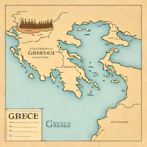
A map of Ancient Greece offers a fascinating glimpse into one of history’s most influential civilizations, showing the geographical layout that shaped its culture, politics, and economy. Unlike modern nations, Ancient Greece was not a unified country but a collection of city-states, known as poleis, each with its own government, army, and customs. These city-states were spread across mainland Greece, the islands of the Aegean Sea, and the western coast of Asia Minor. Understanding the geography through a map helps to explain the rise of major powers such as Athens and Sparta, the importance of trade and maritime activity, and the spread of Greek culture throughout the Mediterranean region. A detailed examination of the map reveals mountains, seas, and strategic locations that were pivotal in shaping historical events and cultural development.
Geographical Features of Ancient Greece
Ancient Greece was characterized by a rugged terrain with numerous mountains, valleys, and coastlines. The mountainous landscape often led to the development of independent city-states rather than a centralized empire. The highlands acted as natural barriers, limiting large-scale invasions and fostering regional diversity. Additionally, the proximity to the sea allowed for extensive maritime trade, exploration, and colonization, which became crucial for economic and cultural expansion. A map of Ancient Greece highlights how geography influenced political boundaries, military strategies, and cultural interactions between neighboring city-states.
Major Regions and City-States
- AtticaHome to Athens, Attica was a fertile region with access to the Aegean Sea, making it a hub for trade, culture, and politics.
- LaconiaThe region of Sparta, known for its military-focused society and strict social structure.
- PeloponnesusA large peninsula in southern Greece that included powerful city-states such as Corinth and Argos.
- ThessalyKnown for its fertile plains and cavalry, Thessaly played an important role in agriculture and military campaigns.
- MacedoniaLocated in the northern part of Greece, Macedonia later became the launching point for Alexander the Great’s conquests.
- CreteThe largest Greek island, famous for the Minoan civilization, which predated classical Greek culture.
Importance of the Seas
The Aegean, Ionian, and Mediterranean Seas were vital to Ancient Greece, enabling trade, warfare, and cultural exchange. City-states with access to the coast, such as Athens, developed powerful navies that dominated the Aegean Sea. The seas connected Greek cities with other civilizations, including Egypt, Persia, and the Italian peninsula, facilitating economic growth and the spread of ideas. A map illustrates the strategic locations of ports and islands, emphasizing how maritime geography contributed to Greece’s prominence in the ancient world.
Significant Islands
- DelosA religious center and a key trading hub in the Cyclades islands.
- RhodesKnown for its maritime strength and the Colossus of Rhodes, one of the Seven Wonders of the Ancient World.
- CreteThe cradle of the Minoan civilization, influential in art, architecture, and trade.
Political Implications of Geography
The fragmented terrain of Ancient Greece contributed to the political independence of its city-states. Each polis developed its own government system, from Athens’ democracy to Sparta’s oligarchy. Mountains and rivers often delineated political boundaries, while seas provided both protection and a means of expansion. Mapping these features allows historians and students to visualize how geography affected alliances, conflicts, and the distribution of power across Greece. For instance, the Peloponnesian War between Athens and Sparta can be better understood by examining the relative positions of these city-states on a map.
Key City-States and Their Influence
- AthensKnown for its cultural, philosophical, and democratic achievements, with strong naval power due to its coastal location.
- SpartaA land-based military power that relied on its strong army and strategic position in Laconia.
- CorinthA commercial hub controlling key land and sea trade routes in the Peloponnesus.
- DelphiA religious and cultural center, famous for the Oracle of Apollo.
Trade and Economy
Ancient Greece’s economy was heavily influenced by its geography. The limited arable land in many regions encouraged trade and colonization. Coastal cities engaged in the exchange of olive oil, wine, pottery, and metals, connecting Greek communities with foreign markets. A map of Ancient Greece illustrates the proximity of key trading routes, ports, and colonies, showing how economic activities were concentrated around accessible regions. The Aegean islands, for instance, served as critical nodes for commercial networks, allowing Greek culture and goods to spread widely.
Colonization and Expansion
- Greek colonies were established in Asia Minor, southern Italy, and the Black Sea region, extending the influence of Greek culture.
- Trade routes shown on maps indicate the movement of goods, people, and ideas across the Mediterranean.
- Economic interdependence among city-states contributed to alliances and sometimes conflicts.
Cultural and Historical Insights
A map of Ancient Greece is more than just a tool for geography it offers insights into the cultural and historical landscape of the era. Temples, theaters, and public spaces were often situated in relation to natural features, providing both strategic advantages and aesthetic value. Sacred sites like Mount Olympus, Delphi, and Olympia are highlighted on maps, revealing their religious and cultural significance. Understanding the placement of these landmarks helps modern audiences appreciate the interplay between environment, religion, and daily life in Ancient Greece.
Major Cultural Sites
- Mount OlympusConsidered the home of the Greek gods, central to mythology and religion.
- DelphiA religious sanctuary and center for prophecy.
- OlympiaThe site of the original Olympic Games, reflecting the cultural emphasis on athletics and competition.
- Acropolis of AthensSymbol of architectural innovation and political power.
Modern Use of Ancient Maps
Today, maps of Ancient Greece serve as educational tools for historians, students, and enthusiasts. They provide context for understanding classical texts, historical battles, and cultural developments. By analyzing the placement of cities, natural barriers, and trade routes, scholars can reconstruct historical events and social dynamics. Additionally, these maps enhance tourism, guiding visitors to archaeological sites and landmarks that preserve the legacy of Ancient Greece.
Applications in Education and Research
- Teaching history and geography together to illustrate how terrain influenced culture and politics.
- Understanding military campaigns, such as the Persian Wars and the Peloponnesian War.
- Analyzing the spread of Greek colonies and cultural influence across the Mediterranean.
- Supporting archaeological research by locating ancient sites and settlements.
A map of Ancient Greece is an essential resource for anyone interested in the classical world. It reveals how geography shaped city-states, trade, culture, and politics. By studying such maps, one gains insight into the challenges and opportunities faced by the Greeks, including the influence of mountains, seas, and fertile plains. These maps provide a visual understanding of Ancient Greece, making it easier to appreciate the civilization’s remarkable achievements in governance, philosophy, art, and warfare. From Athens to Sparta, Crete to Delphi, each location on the map tells a story of human innovation, resilience, and cultural richness, offering a timeless perspective on one of history’s most influential civilizations.