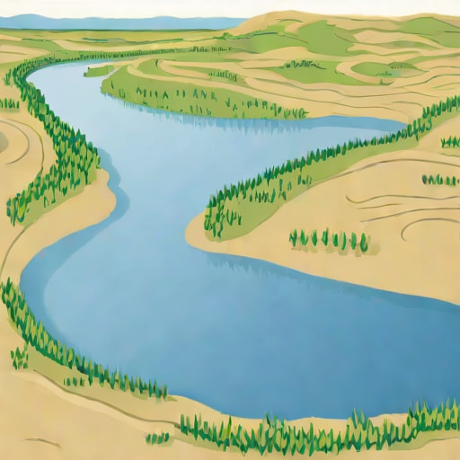
The Yenisei River is one of the great rivers of Siberia and Russia, stretching over thousands of kilometers from its source in Mongolia to its mouth in the Kara Sea. It is renowned not only for its immense length and volume but also for its complex system of tributaries and its significant role in the ecosystems and economies of the regions it flows through. Among the many questions about the Yenisei, one that often arises is how deep is the Yenisei River? Understanding the depth of the river involves looking at various sections along its course, as depth can vary greatly depending on location, season, and environmental conditions. The river’s depth affects navigation, hydropower generation, and local biodiversity, making it an important aspect of the river to study and understand.
Overview of the Yenisei River
The Yenisei River is the largest river system flowing into the Arctic Ocean, with a total length of approximately 5,539 kilometers. Its drainage basin covers a vast area, including parts of Mongolia, Siberia, and Russia. The river originates from the Mongolian mountains and travels through diverse landscapes, including taiga forests, tundra regions, and major urban centers such as Krasnoyarsk. The river plays a crucial role in regional transportation, ecology, and hydropower, supporting communities along its banks and providing a habitat for a variety of aquatic species.
Key Features of the Yenisei
- Length Approximately 5,539 kilometers, making it one of the longest rivers in the world.
- Drainage Basin Covers roughly 2.5 million square kilometers.
- Tributaries Includes major rivers such as the Angara, Tuba, and Kan.
- Climate Influence Flow and depth vary seasonally due to snowmelt, rainfall, and ice coverage.
These features influence the river’s depth, flow rate, and navigability along its entire course.
Depth of the Yenisei River
The depth of the Yenisei River is not uniform; it varies significantly from its upper reaches to its delta. In general, the river is relatively shallow in its mountainous and upper reaches, while its middle and lower courses are deeper, supporting larger vessels and hydropower projects. On average, the river’s depth ranges from 5 to 30 meters in most sections, but certain areas can reach depths of over 100 meters. Factors such as sediment deposition, riverbanks, underwater terrain, and seasonal water flow contribute to these variations.
Upper Reaches Depth
In the upper sections of the Yenisei River, which originate in the mountains of Mongolia and southern Siberia, the river is typically narrower and shallower. Depths in these areas average around 5 to 10 meters. Rapids and rocky sections are common, and the river’s flow is faster due to the steep gradient. These characteristics make the upper Yenisei less suitable for large-scale navigation but rich in ecological diversity and scenic landscapes.
Middle Reaches Depth
As the Yenisei flows northward into central Siberia, it widens and deepens. In this middle course, depths often range from 20 to 30 meters, allowing for larger ships and river transport. Cities like Krasnoyarsk are located along this section, where the river supports both commercial and recreational navigation. The construction of dams and reservoirs, such as the Krasnoyarsk Dam, has also altered the depth and flow patterns, creating deeper sections suitable for hydroelectric power generation.
Lower Reaches and Delta Depth
The lower reaches of the Yenisei, closer to its mouth at the Kara Sea, feature some of the deepest points of the river. In this region, the river can reach depths exceeding 100 meters, particularly in natural channels and areas affected by ice and tidal influences. The delta region is complex, with multiple channels, islands, and sediment deposits, which create variable depths and affect local navigation and ecosystem dynamics. Seasonal flooding and ice cover further influence the depth in these northern reaches.
Factors Influencing Depth
Several factors affect the depth of the Yenisei River along its course. Seasonal changes are particularly significant, with spring snowmelt causing higher water levels and greater depths, while winter ice formation can reduce the effective depth in some sections. Human interventions, such as dam construction, hydroelectric projects, and dredging, also modify natural depth patterns. Additionally, sedimentation from tributaries and erosion of riverbanks can create deeper pools or shallower areas, impacting both navigation and aquatic habitats.
Seasonal Variations
- Spring and Summer Increased flow from snowmelt and rainfall raises the water level and depth.
- Autumn Water levels gradually decrease as precipitation diminishes.
- Winter Ice formation can reduce navigable depth and alter flow patterns.
These variations are crucial for planning navigation, fishing, and hydropower activities along the river.
Importance of the River’s Depth
The depth of the Yenisei River has practical implications for transportation, energy production, and ecological health. Deep sections of the river support cargo and passenger ships, allowing for the movement of goods and people across vast distances in Siberia. Hydropower stations, including the Krasnoyarsk and Sayano-Shushenskaya dams, rely on sufficient river depth to operate efficiently and generate electricity for regional consumption. The depth also affects the river’s aquatic ecosystems, providing habitats for fish species such as sturgeon and salmon, which depend on specific depth ranges for spawning and migration.
Impact on Navigation and Trade
Deep sections of the Yenisei are essential for commercial navigation. Barges and cargo ships transport timber, minerals, and other resources from Siberian regions to ports along the river and eventually to the Arctic Ocean. Seasonal changes in depth influence shipping schedules, as low water levels or ice cover can restrict movement. Understanding the river’s depth is critical for safe and efficient navigation, particularly in remote regions where alternative transport routes are limited.
Ecological Significance
- Supports fish habitats and biodiversity.
- Maintains wetland and floodplain ecosystems.
- Regulates water temperature and flow for aquatic species.
- Influences nutrient distribution along the river basin.
The depth of the Yenisei thus plays a key role in sustaining both human and natural systems throughout its course.
The Yenisei River is one of the longest and most significant rivers in Siberia and Russia, with depths varying from 5 meters in its upper reaches to over 100 meters in certain lower sections. Its depth is influenced by seasonal changes, human interventions such as dams, and natural sedimentation processes. Deep sections of the river enable navigation, hydropower generation, and ecological sustainability, making the Yenisei a vital waterway for transportation, energy, and biodiversity. Understanding how deep the Yenisei River is at various points along its course provides insight into its role in supporting regional economies, ecosystems, and communities. Whether for scientific study, navigation, or resource management, knowledge of the river’s depth is essential for harnessing its full potential and preserving its natural environment.