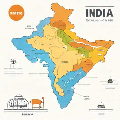
India, known for its diverse culture, rich history, and varied landscapes, occupies a significant portion of South Asia, making it one of the largest countries in the world in terms of both population and geographical area. Understanding the total geographical area of India is crucial for appreciating its natural diversity, planning development projects, managing resources, and studying its environmental and ecological systems. From the towering Himalayan mountains in the north to the tropical coastlines in the south, India’s vast expanse encompasses deserts, plains, plateaus, rivers, and forests. This topic explores the total geographical area of India, its distribution across states and territories, and the significance of its size in various aspects of life, governance, and economy.
Total Geographical Area of India
Overview
India has a total geographical area of approximately 3.287 million square kilometers (1.269 million square miles), making it the seventh-largest country in the world by land area. This total area includes both land and water bodies within the country, accounting for rivers, lakes, and reservoirs. The vast geographical area of India contributes to its incredible diversity, from climate zones and soil types to ecosystems and natural resources.
Land Distribution
The land of India is divided among 28 states and 8 union territories, each with its unique landscape and area. Some of the largest states by area include Rajasthan, Madhya Pradesh, Maharashtra, and Uttar Pradesh, while the smaller union territories like Lakshadweep and Chandigarh cover only a few square kilometers. The distribution of land area influences population density, resource availability, and economic development patterns across the country.
Breakdown by Regions
India’s geographical area can be broadly categorized into several regions
- The Northern MountainsIncluding the Himalayan ranges, which cover parts of Jammu & Kashmir, Himachal Pradesh, and Uttarakhand.
- The Indo-Gangetic PlainsFertile plains stretching across Punjab, Haryana, Uttar Pradesh, Bihar, and West Bengal.
- The Peninsular PlateauThe Deccan Plateau and surrounding regions, covering states like Maharashtra, Karnataka, Andhra Pradesh, and Tamil Nadu.
- Deserts and Arid RegionsThe Thar Desert in Rajasthan and adjoining areas.
- Coastal AreasThe eastern and western coastlines along the Bay of Bengal and the Arabian Sea.
- Island TerritoriesThe Andaman and Nicobar Islands and Lakshadweep, which are part of India’s total geographical area.
Significance of India’s Geographical Area
Economic Importance
The extensive geographical area of India allows for a variety of economic activities. Agricultural production benefits from fertile plains, industrial development thrives in urban centers across the country, and natural resources such as minerals, forests, and water bodies are distributed throughout the land. The large area also supports diverse climate zones that enable the cultivation of different crops, from rice and wheat in the plains to tea, coffee, and spices in the hills and southern regions.
Political and Administrative Implications
India’s vast geographical area has significant implications for governance and administration. Managing a country of over 3.2 million square kilometers requires careful planning of infrastructure, transportation, public services, and law enforcement. Each state and union territory has its own administrative machinery to ensure effective governance while coordinating with the central government. The large area also necessitates regional planning and disaster management strategies, especially in regions prone to earthquakes, floods, or cyclones.
Environmental and Ecological Diversity
The total geographical area of India contributes to its immense ecological diversity. India is home to numerous ecosystems, including forests, wetlands, deserts, grasslands, and coastal regions. This diversity supports a wide range of flora and fauna, some of which are endemic and protected under conservation programs. The geographical spread also means that India has multiple climatic zones, from alpine conditions in the north to tropical climates in the south, which influence biodiversity and natural resource management.
Geographical Features Affecting Area Distribution
Mountains and Plateaus
The northern Himalayan ranges occupy a significant portion of India’s total area, providing natural borders and influencing climate patterns. Similarly, the peninsular plateau in the south contributes to the elevation and topographical diversity of the country. These features impact land use, agriculture, and settlement patterns across India.
Rivers and Water Bodies
India’s rivers, such as the Ganga, Yamuna, Brahmaputra, and Godavari, along with numerous lakes and reservoirs, are integral to the total geographical area. Water bodies not only occupy physical space but also provide vital resources for irrigation, drinking water, and hydroelectric power, supporting both rural and urban populations.
Deserts and Coastal Areas
The Thar Desert in Rajasthan represents arid land that is less densely populated but rich in mineral resources. India’s extensive coastline, stretching over 7,500 kilometers, adds to the total geographical area and supports maritime trade, fishing industries, and tourism. The coastal plains are crucial for transportation, commerce, and cultural exchange.
Comparison with Other Countries
Global Ranking
With a total geographical area of approximately 3.287 million square kilometers, India ranks seventh in the world. Countries larger than India include Russia, Canada, China, the United States, Brazil, and Australia. Despite being smaller in area compared to these countries, India has one of the highest population densities, making its geographical management and land use particularly significant.
Land Area vs. Population Density
India’s large geographical area must support over 1.4 billion people, making effective land use planning essential. High population density in some regions contrasts with sparsely populated deserts, mountains, and island territories. Understanding the distribution of India’s area helps policymakers address challenges related to urban planning, resource management, and sustainable development.
The total geographical area of India, approximately 3.287 million square kilometers, is a defining feature of the country’s identity, diversity, and global standing. This vast expanse encompasses mountains, plains, plateaus, deserts, coastal regions, and islands, each contributing to India’s ecological, economic, and cultural richness. The distribution of land across states and union territories, combined with varied climates and natural resources, supports diverse agriculture, industry, and human settlements. The country’s large area also presents unique challenges in governance, infrastructure development, and environmental conservation, requiring careful planning and management. India’s geographical area not only shapes its natural and human landscapes but also influences its position on the global stage, highlighting the significance of understanding, preserving, and utilizing this space effectively. Whether for economic planning, ecological studies, or social development, the total geographical area of India remains central to its progress and identity, showcasing the interplay between land, resources, and human activity in one of the world’s most remarkable nations.